")

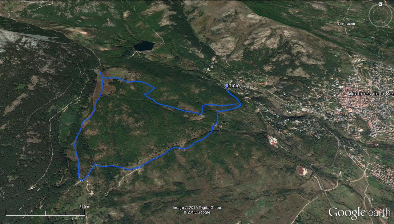
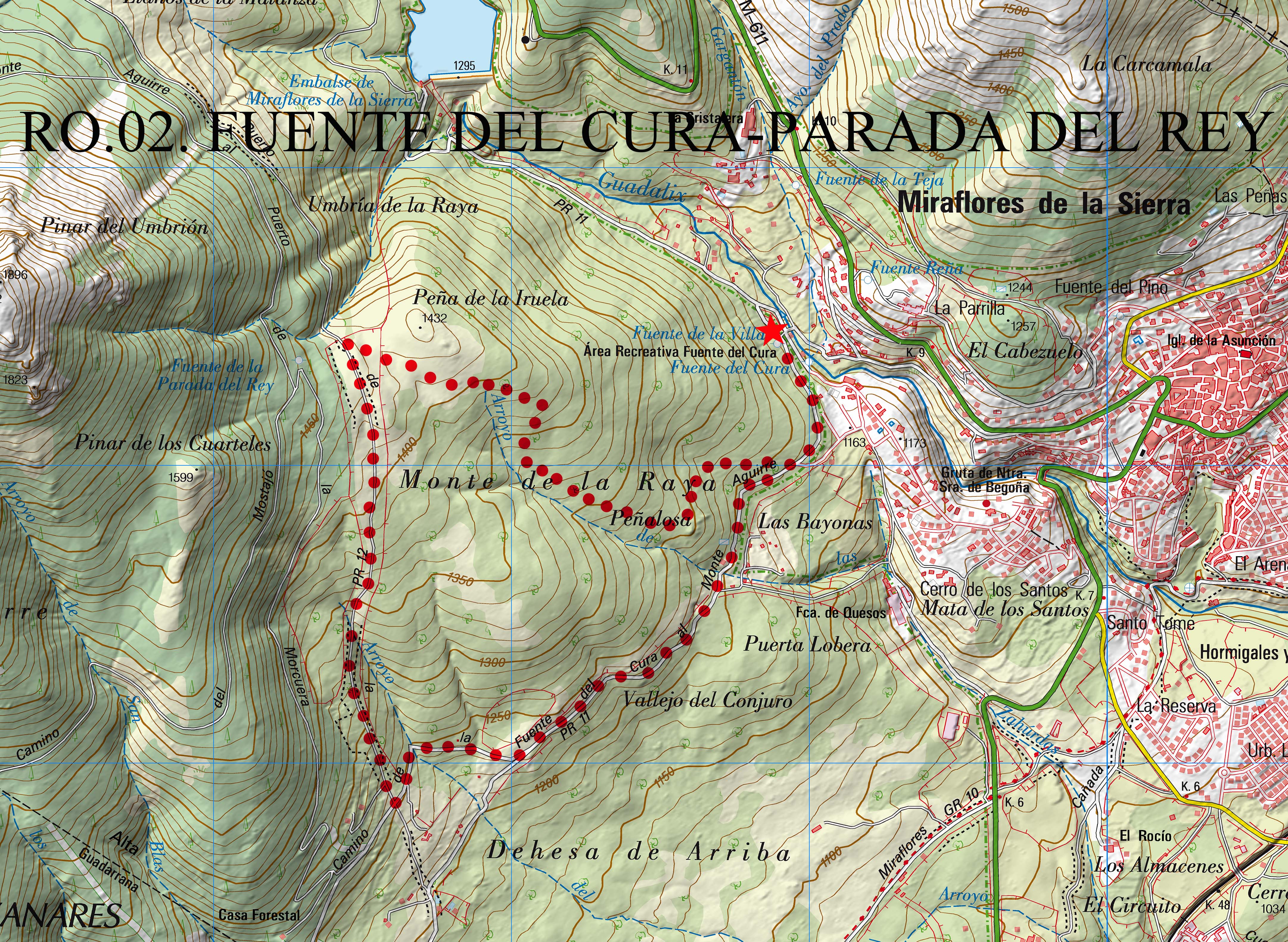
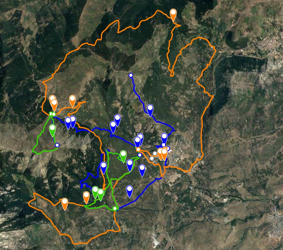
Fuente del Cura – Parada del Rey- Fuente del Cura
Distance: 7,02 km (circular).
Time: 2,5 h.Estimated time allowing for pauses to observe the faunaDifficulty: low.
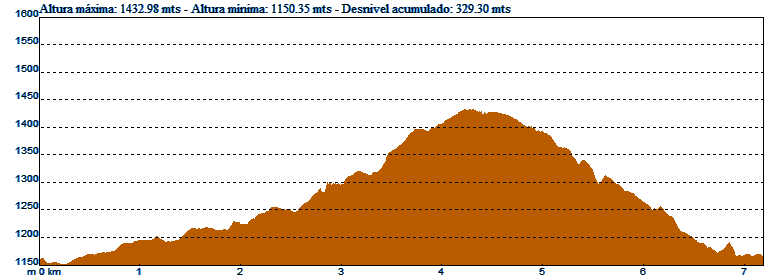
Ascent: 324m.
Max / average / minimum altitude: 1433m/1283m/1150m.
Maximum gradient: 19,3 - 20,2%.
Average gradient: 7,8 - 8,9%.
Terrain: Forest tracks and paths.
Recommended time of year: Spring and autumn
Observations: Take plenty of water in summer, and watch out for ice in winter. The only source of water is at the start of the walk. (Fuente del Cura recreation area).
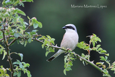
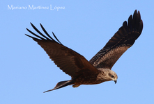
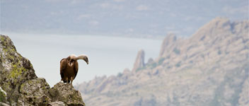
Resident species: golden eagle, goshawk, red kite, griffin vulture, black vulture, shrike, cirl bunting, common chaffinch, stonechat, woodpecker, lesser spotted woodpecker, crested tit, great tit, coal tit, long tailed, tit, Eurasian nuthatch, short-toed tree creeper,firecrest, jay, azure-winged magpie, common chaffinch, wren.
Species found in summer: booted eagle, European bee eater,black kite, short-toed eagle, golden oriole, bee eater, red-backed shrike, woodchat shrike, subalpine warbler, common whitethroat, common warbler, common nightingale, Bonelli’s warbler, pied flycatcher, common cuckoo, European turtledove, red-rumped swallow
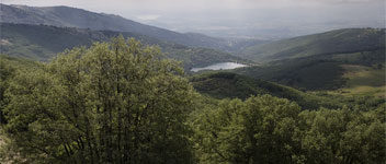
Starting in the Fuente del Cura recreative area, go southeast up the road on the left which passes through an area of melojo oak trees. Continue along the track for approximately 1,5km until you reach a crossroads. Stop to admire the panoramic views from the Muñequilla natural viewpoint, and then continue along the track on the right.
In little less than 1km, where the track opens out, walk up a concrete road going off to the right marked with yellow and white signs signposting the short-distance footpath (PR11). This footpath, known as the Cordel del Puerto, was used by shepherds and cattle breeders to drive their livestock up to the nearby Morcuera mountain pass. After a short, steep ascent,pass through a gate,taking care to leave it shut.
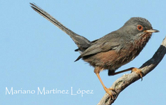
The path comes out into an open area covered with streams and bushes. On one side,there is a pine forest and on the other, an oak forest. This transitional area between different habitats offers a great opportunity to stop and observe a wide variety of birds. It is also a wonderful place to see the many birds of prey in the area.
Although the track is not clear at this point, carry on straight ahead and then ascend through a rocky area covered in broom which leads to an area of fields called the Parada del Rey. Cross the fields and head towards a group of large oak trees. This is a good place to stop and look for more birds, and take the opportunity to go into the pine forest to observe other species.
Start to walk back in a south-east direction leaving the group of oak treesbehind and after crossing an old stone wall, walk across the fields towards the oak forest following the SL.02 route which goes through the Monte de la Raya oak forest. Descend for 2km to reach the starting point and the end of the walk.